


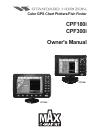


Page 8 CPF180i and CPF300i
4. FIND SERVICES ...................................................................................................... 41
4.0 USING FIND SERVICES & MORE FUNCTIONS .................................................. 41
4.0.0 Port Services.............................................................................................. 41
4.0.1 Port ...................................................................................................... 41
4.0.2 Tide Stations .............................................................................................. 42
4.0.3 Wrecks ...................................................................................................... 43
4.0.4 Obstructions ............................................................................................... 43
4.0.5 Lakes Information ......................................................................................44
4.0.6 Lakes By Name ......................................................................................... 45
4.0.7 Points Of Interest ....................................................................................... 46
4.0.8 User Points ................................................................................................ 47
4.0.9 Coordinates ................................................................................................ 47
5. OPTIONAL C-MAP BY JEPPESEN MAX CARTOGRAPHY OVERVIEW ............................ 49
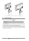
5.0 INSERTING THE C-CARD ..................................................................................... 49
6. MAP FUNCTIONS ...................................................................................................... 51
6.0 MAX FUNCTIONS MENU ...................................................................................... 51
6.0.0 Zoom Type ................................................................................................. 51
6.0.1 Place Names size ...................................................................................... 51
6.0.2 Perspective View ....................................................................................... 52
6.0.3 Dynamic Nav-Aids ..................................................................................... 52
6.0.4 Safety Status Bar (DSI - Data Safety Indicator) ........................................ 53
6.0.5 Satellite Imagery ........................................................................................ 54
6.0.6 Currents Prediction .................................................................................... 54
6.0.7 Chart Language ......................................................................................... 55
6.0.8 Pictures & Diagrams .................................................................................. 56
How to show the pictures or diagrams of a Multimedia Object................. 56
6.0.9 Enhanced Port Info .................................................................................... 57
7. CREATING MARKS ...................................................................................................... 59
7.0 CREATING A NEW MARK USING THE CHART PAGE ....................................... 59
7.1 EDITING A MARK .................................................................................................. 59
7.1.0 Deleting a Mark or Waypoint ..................................................................... 60
7.1.1 Moving a Mark or Waypoint ....................................................................... 60
7.2 MARKS/WAYPOINTS LIST ................................................................................... 61
7.3 CREATING A NEW MARK WITH THE USER POINTS LIST ...............................62
7.4 GOTO CURSOR ..................................................................................................... 62
7.5 GOTO MARK ...................................................................................................... 63
7.6 GOTO ROUTE ...................................................................................................... 63
8. MAN OVER BOARD (MOB) FUNCTION ......................................................................... 65
8.0 DELETING A MOB POINT ..................................................................................... 65
9. ROUTES ...................................................................................................... 67
9.0 CREATING A ROUTE USING WAYPOINTS ........................................................ 67
9.1 MAKING ADDITIONAL ROUTES ........................................................................... 68
9.2 CREATING A ROUTE USING MARKS ON THE CHART PAGE .......................... 68
9.3 INSERTING A WAYPOINT INTO A ROUTE ......................................................... 69
9.4 GOTO A ROUTE .................................................................................................... 69
9.4.0 By select Route .......................................................................................... 69
9.4.1 By Cursor key ............................................................................................ 69
9.5 DELETING A ROUTE ............................................................................................. 69