


CPF180i and CPF300i Page 49
5. OPTIONAL C-MAP BY JEPPESEN MAX
CARTOGRAPHY OVERVIEW
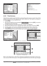
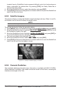
5.0 INSERTING THE C-CARD
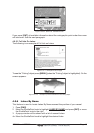
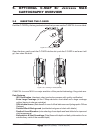
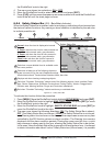
Hold the C-CARD by the long inclined side so that you can see the C-MAP BY JEPPESEN label.
Figure 5.0 - Inserting C-CARD
Open the door, gently push the C-CARD into the slot: push the C-CARD in as far as it will
go, then close the door.
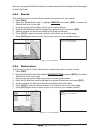
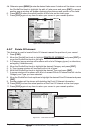
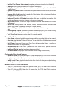
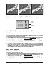
Figure 5.0a - Inserting C-CARD (details)
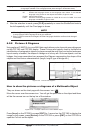
C-MAP BY JEPPESEN MAX is a major evolution of the product technology. Key points are:
Data Features
· ISO Certification (electronic chart production process with quality certification)
· Extra Large Coverage (all the C-Map electronic chart detail and a huge coverage
without having to change cartridge)
· Official data source (data based on use of official data sources Hydrographic Offices
Release)
· Detailed World Background (worldwide background chart with details)
· Depths & Land Elevation (color shading of sea depth and land altitude for improved
chart appearance)
· Bathymetric & Spot Soundings (Data Base with depth and bathy information for an
extraordinary view of the seabed depth)