


4-3190-00601-02 Rev. E
Garmin G600 Pilot’s Guide
Foreword
Sec 1
System
Sec 2
PFD
Sec 3
MFD
Sec 4
Hazard
Avoidance
Sec 5
Additional
Features
Sec 6
Annun.
& Alerts
Sec 7
Symbols
Sec 8
Glossary Appendix A
Appendix B
Index
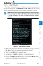
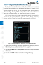
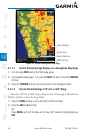
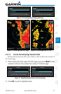
Each of the terrain awareness configurations are detailed in the following
sub-sections.
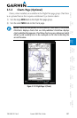
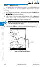
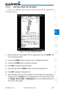
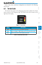
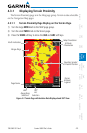
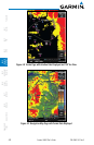
4.2 Terrain Scale
The Terrain Scale option in the Map page group selects whether the Terrain
Scale is shown on the Navigation Map. The Terrain scale will be located on the
right side of the display.
Figure 4-1 Terrain Scale
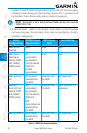
Color Description
Red Terrain is more than 100 ft above the aircraft.
Yellow Terrain is between 1000 ft below and 100 ft above the aircraft.
Black Terrain is more than 1000 ft below the aircraft.
Table 4-2 Terrain Scale Color Codes