


4-117190-00601-02 Rev. E
Garmin G600 Pilot’s Guide
Foreword
Sec 1
System
Sec 2
PFD
Sec 3
MFD
Sec 4
Hazard
Avoidance
Sec 5
Additional
Features
Sec 6
Annun.
& Alerts
Sec 7
Symbols
Sec 8
Glossary Appendix A
Appendix B
Index
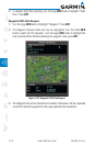
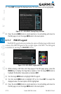
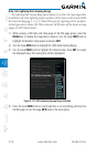
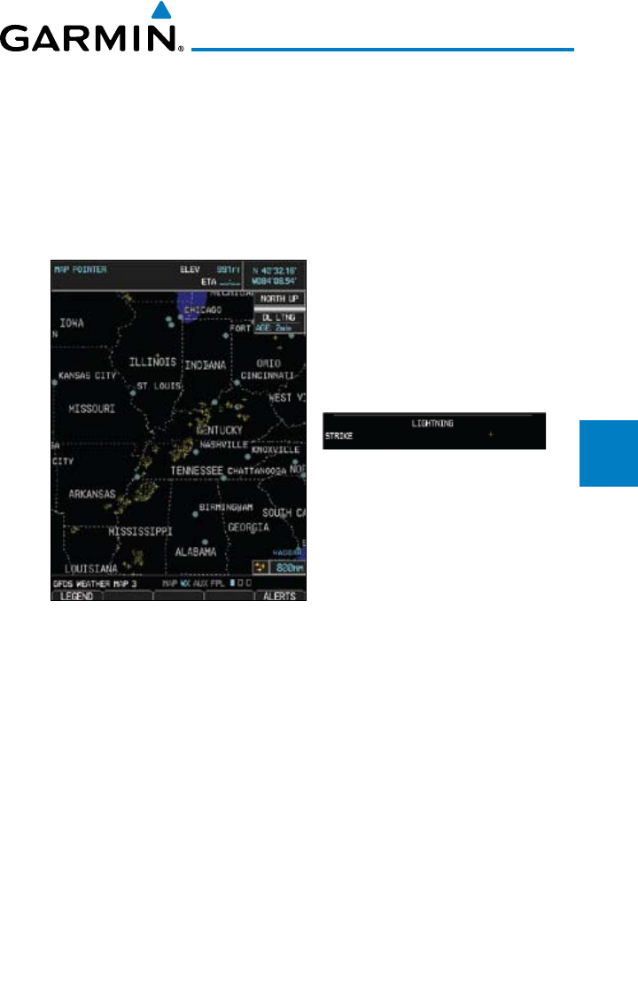
4.11.9 Data Link Lightning (DL LTNG) Data Viewing
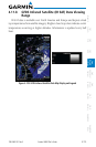
Range
Lightning data shows the approximate location of cloud-to-ground lightning
strikes. A strike icon represents a strike that has occurred within a two-kilometer
region. The exact location of the lightning strike is not displayed. Only cloud to
ground strikes are reported in the US and extreme southern Canada (cloud to
cloud strikes are not reported).
Figure 4-111 GFDS Data Link Lightning and Legend