


3-2
Garmin G600 Pilot’s Guide
190-00601-02 Rev. E
Foreword
Sec 1
System
Sec 2
PFD
Sec 3
MFD
Sec 4
Hazard
Avoidance
Sec 5
Additional
Features
Sec 6
Annun.
& Alerts
Sec 7
Symbols
Sec 8
GlossaryAppendix A
Appendix B
Index
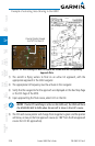
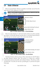
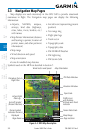
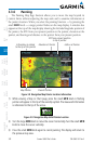
There are 28 different map ranges available, from 500 feet to 2000 NM.
The current range is indicated in the lower right corner of the map and
represents the top-to-bottom distance covered by the map. To change the
map range on any map, press the RNG keys on the right side of the bezel.
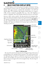
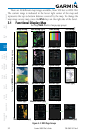
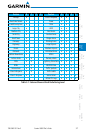
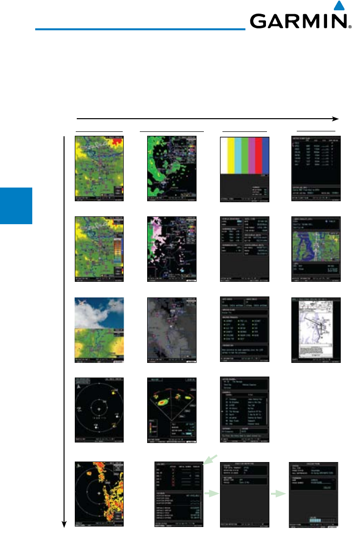
3.1 Functional Display Map
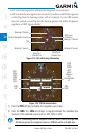
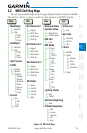
Pos Report (opt)
Map Group Wx Group (opt) Aux Group
FPL Group
Wx Data 1 (opt)
Wx Data 2 (opt)
Wx Data 3 (opt)
System Setup
XM Info (opt)
XM Radio (opt)
System Status
Active FPL
Wpt Info
Charts (opt)
Turn large MFD knob to change page groups
Turn small MFD knob to select pages within a group
Weather Radar (opt)
Nav Map 1
Nav Map 2
Traffic (opt)
Terrain (TAWS/SVT opt)
Split Screen (opt)
Ext Video (opt)
Iridium Phone (opt)
Figure 3-2 MFD Page Groups