


4-63190-00601-02 Rev. E
Garmin G600 Pilot’s Guide
Foreword
Sec 1
System
Sec 2
PFD
Sec 3
MFD
Sec 4
Hazard
Avoidance
Sec 5
Additional
Features
Sec 6
Annun.
& Alerts
Sec 7
Symbols
Sec 8
Glossary Appendix A
Appendix B
Index
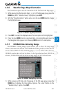
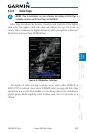
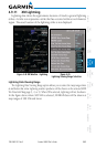
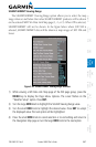
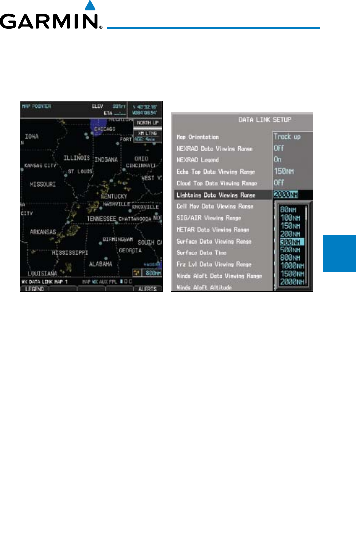
4.9.11 XM Lightning
Lightning data shows the approximate location of cloud-to-ground lightning
strikes. A strike icon represents a strike that has occurred within a two-kilometer
region. The exact location of the lightning strike is not displayed.
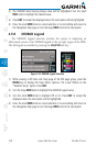
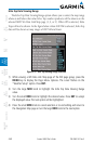
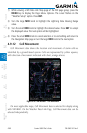
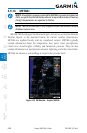
Figure 4-44 XM Weather - Lightning Figure 4-45
Lightning Viewing Range Selection
Lightning Data Viewing Range
The Lightning Data Viewing Range option allows you to select the map range where
at and below that value Lightning weather products will be shown on the selected MFD
Wx Data Link Map page (1, 2, or 3). When Off is selected, Lightning will not be shown.
In the figure above where 300 NM is selected, NEXRAD data will be shown at
map ranges of 300 NM and lower.