


4-121190-00601-02 Rev. E
Garmin G600 Pilot’s Guide
Foreword
Sec 1
System
Sec 2
PFD
Sec 3
MFD
Sec 4
Hazard
Avoidance
Sec 5
Additional
Features
Sec 6
Annun.
& Alerts
Sec 7
Symbols
Sec 8
Glossary Appendix A
Appendix B
Index
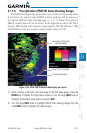
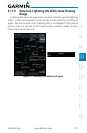
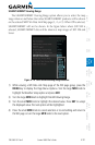
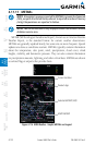
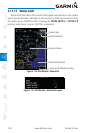
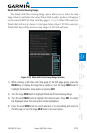
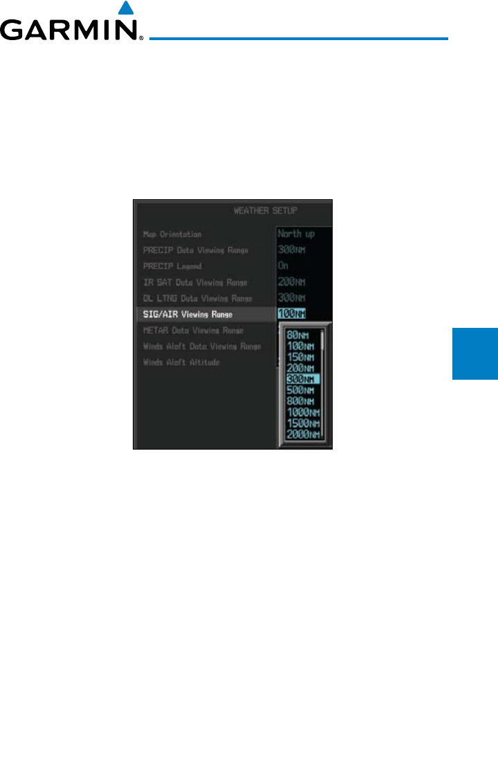
SIGMET/AIRMET Viewing Range
The SIGMET/AIRMET Viewing Range option allows you to select the map
range where at and below that value SIGMET/AIRMET products will be shown
on the selected MFD Wx Data Link Map page (1, 2, or 3). When Off is selected,
SIGMET/AIRMET will not be shown. In the figure below where 300 NM is
selected, SIGMET/AIRMET data will be shown at map ranges of 300 NM and
lower.
Figure 4-115 GFDS SIG/AIR Viewing Range Selection
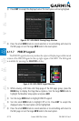
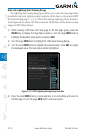
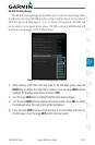
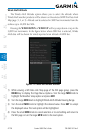
1) While viewing a WX Data Link Map page of the WX page group, press the
MENU key to display the Page
Menu Options
. Turn the large MFD knob to
highlight the Weather Setup option and press ENT
.
2) Turn the large MFD knob to highlight SIG/AIR Viewing Range.
3) Turn the small MFD knob to highlight the desired value. Press ENT
to accept
the displayed value. The next option will be highlighted.
4) Press the small MFD knob to cancel selection or to end editing and return to
the WX page or turn the large MFD knob to the next option.