


4-12
Garmin G600 Pilot’s Guide
190-00601-02 Rev. E
Foreword
Sec 1
System
Sec 2
PFD
Sec 3
MFD
Sec 4
Hazard
Avoidance
Sec 5
Additional
Features
Sec 6
Annun.
& Alerts
Sec 7
Symbols
Sec 8
GlossaryAppendix A
Appendix B
Index
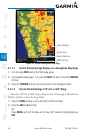
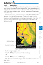
4.4.5 Using TAWS
During G600 power-up, the terrain/obstacle database versions are displayed
along with a disclaimer to the pilot. At the same time, TAWS self-test begins.
One of the following aural messages is generated:
•“TAWS System Test OK”
•“TAWS System Failure”
TAWS information can be displayed on the MFD in the TAWS page of the
MAP page group.
Terrain and obstacles with heights greater than 200 feet
Above Ground Level (AGL) are displayed in yellow and red. The G600
adjusts colors automatically as the aircraft altitude changes.
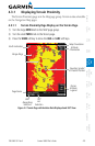
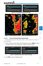
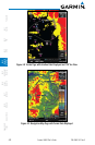
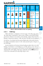
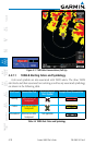
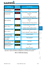
4.4.6 Displaying TAWS Data
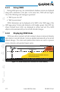
TAWS uses yellow (caution) and red (warning) to depict terrain and obstacles
alerts relative to aircraft altitude. Colors are adjusted automatically as the aircraft
altitude changes. The colors and symbols shown below are used to represent
terrain, obstacles, and potential impact points.
Potential Impact Point
Unlighted Obstacle
Projected Flight Path
1000 ft
100 ft Threshold
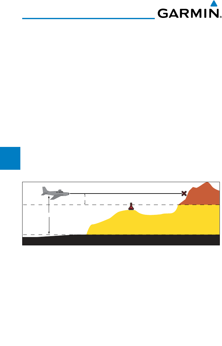
Terrain more than 1000 ft below the aircraft altitude (Black)
Terrain between 100 ft and 1000 ft below the
aircraft altitude (Yellow)
Terrain above or
within 100 ft
below the aircraft
altitude (Red)
Figure 4-10 Terrain Altitude/Color Correlation for Terrain Proximity