


3-25190-00601-02 Rev. E
Garmin G600 Pilot’s Guide
Foreword
Sec 1
System
Sec 2
PFD
Sec 3
MFD
Sec 4
Hazard
Avoidance
Sec 5
Additional
Features
Sec 6
Annun.
& Alerts
Sec 7
Symbols
Sec 8
Glossary Appendix A
Appendix B
Index
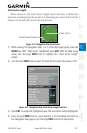
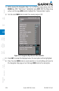
3) Press ENT
to accept the displayed value. The next option will be highlighted.
4) Press the small MFD knob to cancel selection or to end editing and return to
the Navigation Map page or turn the large MFD knob to the next option.
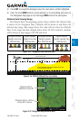
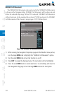
Obstacle Data Viewing Range
The Obstacle Data Viewing Range option selects whether the Obstacle Data
is shown on the Navigation Map. Obstacles will be shown at and below the
selected map range. Map ranges above this value will not show the Obstacle
Data. In the range selection example below where 30 NM is selected, obstacles
will be shown at map ranges of 30 NM and lower.
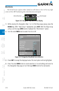
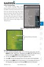
Unlighted Obstacle
(Height is less than
1000 feet AGL)
Lighted Obstacle
(Height is less than
1000 feet AGL)
Unlighted Obstacle
(Height is greater
than 1000 feet AGL)
Lighted Obstacle
(Height is greater than
1000 feet AGL)
Figure 3-35 Navigation Map Obstacle Icons
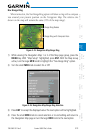
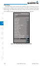
Potential Impact Point
Unlighted Obstacle
Projected Flight Path
1000 ft
100 ft Threshold
Terrain more than 1000 ft below the aircraft altitude (Black)
Terrain between 100 ft and 1000 ft below the
aircraft altitude (Yellow)
Terrain above or
within 100 ft
below the aircraft
altitude (Red)
Figure 3-36 TERRAIN Altitude/Color Correlation
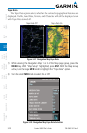
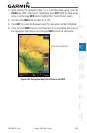
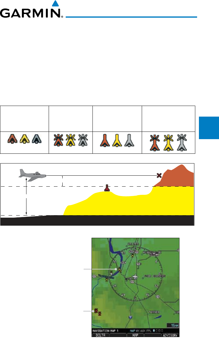
Obstacles Within
1000 feet of Aircraft
Obstacles Within 100 feet
of Aircraft or Above
Figure 3-37 Navigation Map Obstacle Data