


Garmin G1000H
™
Pilot’s Guide for the Bell 407GX
190-01255-00 Rev. B152
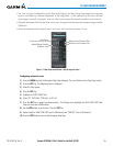
FLIGHT MANAGEMENT
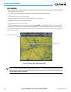
TOPOGRAPHY
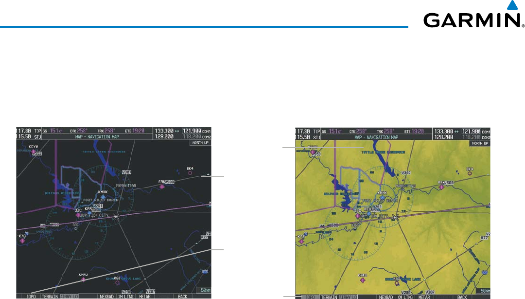
All navigation maps can display various shades of topography colors representing land elevation, similar
to aviation sectional charts. Topographic data can be displayed or removed as described in the following
procedures.
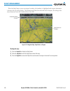
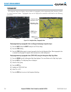
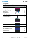
Navigation Map
Black Background
TOPO Off
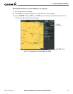
Figure 5-14 Navigation Map - Topographic Data
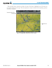
TOPO Softkey
Enabled
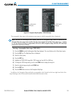
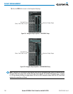
Navigation Map
Topographic Data
TOPO On
TOPO Softkey
Not Enabled
Displaying/removing topographic data on all pages displaying navigation maps:
1) Press the MAP Softkey (the INSET Softkey for the PFD Inset Map).
2) Press the TOPO Softkey.
3) Press the TOPO Softkey again to remove topographic data from the Navigation Map. When topographic data
is removed from the page, all navigation data is presented on a black background.
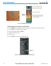
Displaying/removing topographic data (TOPO DATA) using the Navigation Map Page Menu:
1) Press the MENU Key with the Navigation Map Page displayed. The cursor flashes on the ‘Map Setup’ option.
2) Press the ENT Key. The Map Setup Menu is displayed.
3) Select the ‘Map’ group.
4) Press the ENT Key.
5) Highlight the ‘TOPO DATA’ field.
6) Select ‘On’ or ‘Off’.
7) Press the FMS Knob to return to the Navigation Map Page.