


Garmin G1000H
™
Pilot’s Guide for the Bell 407GX
190-01255-00 Rev. B 381
ADDITIONAL FEATURES
Descent anD aPPROach
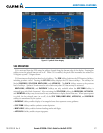
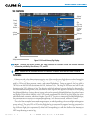
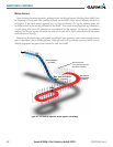
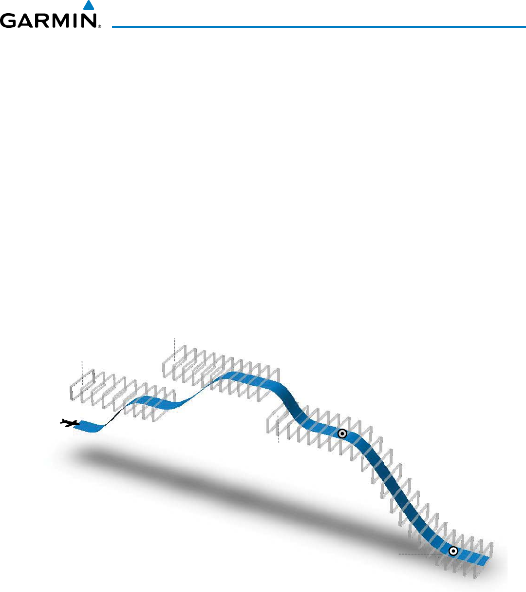
Pathwaysareshowndescendingonlyforaprogrammeddescent(Figures8-5,8-6).Whentheightplan
includesprogrammeddescentsegments,pathwaysaredisplayedalongthedescentpathprovidedthatthe
selectedaltitudeislowerthantheprogrammedaltitude.
Whenan approachprovidingvertical guidanceis activated,Pathwaysare shownlevelat theselected
altitudeuptothepointalongthenalapproachcoursewherethealtitudeinterceptstheextendedvertical
descentpath,glidepath,orglideslope.Fromtheverticalpathdescent,glidepath,orglideslopeintercept
point,thepathwaysareshowninboundtotheMissedApproachPoint(MAP)alongthepublishedlateral
andverticaldescentpath,orattheselectedaltitude,whicheverislower.
DuringanILSapproach,theinitialapproachsegmentisdisplayedinmagentaatthesegmentaltitudes
ifGPSisselectedasthenavigationsourceontheCDI.WhenswitchingtolocalizerinboundwithLOC
selectedasthenavigationsourceontheCDI,pathwaysaredisplayedingreenalongthelocalizerandglide
slope.
VOR,LOCBC,andADFapproachsegmentsthatareapprovedtobeownusingGPSaredisplayedin
magentaboxes.SegmentsthatareownusingotherthanGPSorILS,suchasheadinglegsorVORnal
approachcoursesarenotdisplayed.
Figure 8-5 SVS Pathways, Enroute and Descent
Climbs NOT
displayed
by pathway
TOD
Programmed descent
displayed by pathway
Selected Altitude
set for Departure
Selected Altitude
set for Enroute
Selected Altitude or Programmed Altitude
(whichever is higher)
Selected Altitude
for Step Down
Non-programmed descents NOT displayed by pathway