190-01255-00 Rev. B
Garmin G1000H
™
Pilot’s Guide for the Bell 407GX
359
HAZARD AVOIDANCE
Whenpairedwitha1090MHzextendedsquittertransponder,theGTS800usesAutomaticDependent
Surveillance - Broadcast (ADS-B) data from participating airborne aircraft transponders to enhance the
positionalaccuracyanddisplayoftrafcwithintheTASsurveillancerange.Trafcdatasuppliedonlyby
ADS-BGroundBasedTransceivers(GBTs)isnotdisplayed.
TAS SYMBOLOGY
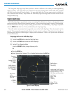
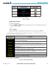
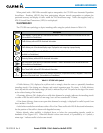
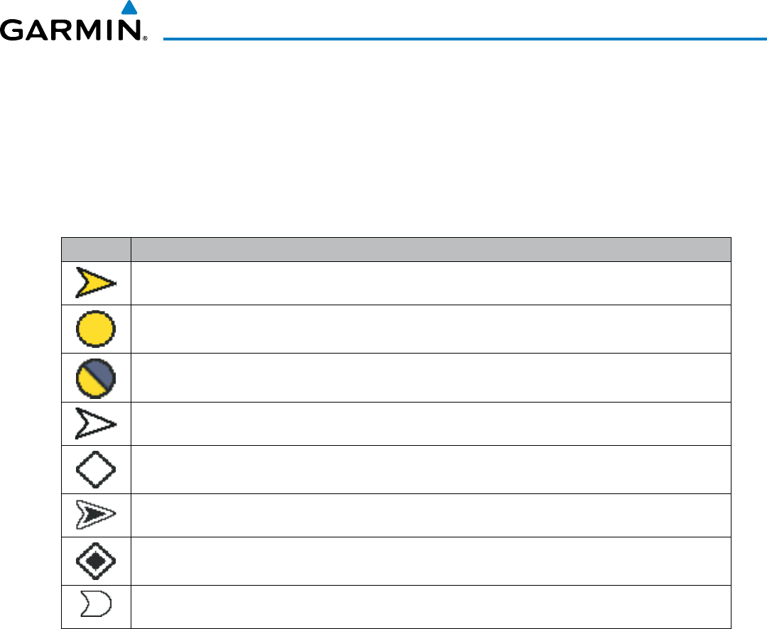
TheGTS800usessymbologytodepictintrudingtrafcusingthesymbolsshowninTable6-16.
Symbol Description
Traffic Advisory (TA) arrow with ADS-B directional information. Points in the direction of the intruder aircraft track.
(Not available in all installations.)
Traffic Advisory without ADS-B directional information.
Traffic Advisory out of the selected display range. Displayed at outer range ring at proper bearing.
Proximity Advisory (PA) arrow with ADS-B directional information. Points in the direction of the aircraft track. (Not
available in all installations.)
Proximity Advisory without ADS-B directional information.
Non-threat traffic arrow with ADS-B directional information. Points in the direction of the intruder aircraft track.
(Not available in all installations.)
Non-Threat Traffic without ADS-B directional information
PA or Non-threat traffic arrow with ADS-B directional information, but positional accuracy is degraded. Points in the
direction of the aircraft track. (Not available in all installations.)
Table 6-16 GTS 800 Traffic Symbols
ATrafcAdvisory(TA),displayedasayellowcircleortriangle,alertsthecrewtoapotentiallyhazardous
intrudingaircraft,iftheclosingrate,distance,andverticalseparationmeetTAcriteria.ATrafcAdvisory
thatisbeyondtheselecteddisplayrange(offscale)isindicatedbyahalfTAsymbolattheedgeofthescreen
attherelativebearingoftheintruder.
AProximityAdvisory(PA),displayedasasolidwhitediamondortriangle,indicatestheintrudingaircraft
iswithin±1200feetandiswithina6nmrange,butisstillnotconsideredaTAthreat.
ANon-threatAdvisory,shownasanopenwhitediamondortriangle,isdisplayedfortrafcbeyond6nm
thatisneitheraTAorPA.
AsolidwhiteroundedarrowindicateseitheraPAorNon-ThreattrafcwithADS-Bdirectionalinformation,
butthepositionofthetrafcisshownwithdegradedaccuracy.
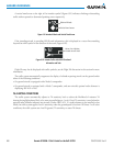
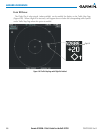
Relative altitude, when available, is displayed above or below the corresponding intruder symbol in
hundredsoffeet(Figure6-91).Whenthisaltitudeisaboveownaircraft,itisprecededbya‘+’symbol;a
minussign‘-’indicatestrafcisbelowownaircraft.


