


Garmin G1000H
™
Pilot’s Guide for the Bell 407GX
190-01255-00 Rev. B360
HAZARD AVOIDANCE
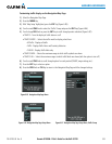
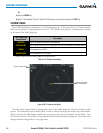
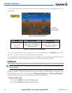
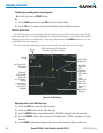
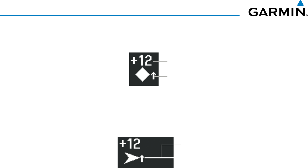
Averticaltrendarrowtotherightoftheintrudersymbol(Figure6-91)indicatesclimbingordescending
trafcwithanupwardordownward-pointingarrowrespectively.
Relative Altitude
Vertical trend arrow
Figure 6-91 Intruder Altitude and Vertical Trend Arrow
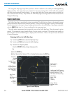
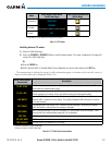
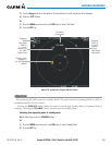
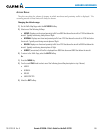
IftheintrudingaircraftisprovidingADS-Btrackinformation,thisisdisplayedasavectorlineextending
beyondthetrafcsymbolinthedirectionofthetrack(Figure6-92).
Vector Line indicates
intruder aircraft track
Figure 6-92 Intruder Traffic with ADS-B Directional
Information and Track
FlightIDsmayalsobedisplayedwithtrafcsymbols;seetheFlightIDsdiscussioninthissectionformore
information.
Thetrafcsystemautomaticallysuppressesthedisplayofaltitude-reportingaircraftonthegroundunder
either of the following conditions:
•On-groundaircraftisequippedwithaModeStransponder.
•On-groundaircraftisequippedwithaModeCtransponder,andownaircraft’soptionalradaraltimeteris
displaying400’AGLorless.
TA ALERTING CONDITIONS
The trafcsystem automaticallyadjusts itsTAsensitivity levelto reduce thelikelihood ofnuisance TA
alertingduringightphaseslikelytobenearairports/heliports.LevelA(less)TAsensitivityisusedwhenthe
optionalradaraltimeterindicatesownaircraftisbelow2000’AGL.Ifaradaraltimeterisnotinstalledorhas
failed,thetrafcsystemappliesLevelAsensitivitywhenthegroundspeedislessthan120knots.Inallother
conditions,thetrafcsystemusesLevelB(greater)TAsensitivitytoassessTAthreats.