


190-01255-00 Rev. B
Garmin G1000H
™
Pilot’s Guide for the Bell 407GX
169
FLIGHT MANAGEMENT
5.3 WAYPOINTS
Waypoints are predetermined geographical positions (internal database) or pilot-entered positions, and are
used for all phases of flight planning and navigation.
Communicationandnavigationfrequenciescanbetuned“automatically”fromvariousWaypointInformation
(WPT) pages, Nearest (NRST) pages, and the Nearest Airports Window (on PFD). This auto-tuning feature
simpliesfrequencyentryovermanualtuning.RefertotheAudioPanelandCNSsectionfordetailsonauto-
tuning.
Waypoints can be selected by entering the ICAO identifier, entering the name of the facility, or by entering
the city name. See the System Overview section for detailed instructions on entering data in the system. As a
waypoint identifier, facility name, or location is entered, the system’s Spell’N’Find™ feature scrolls through the
database, displaying those waypoints matching the characters which have been entered to that point. A direct-to
navigation leg to the selected waypoint can be initiated by pressing the Direct-to Key on any of the waypoint
pages.
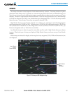
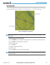
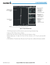
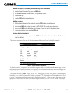
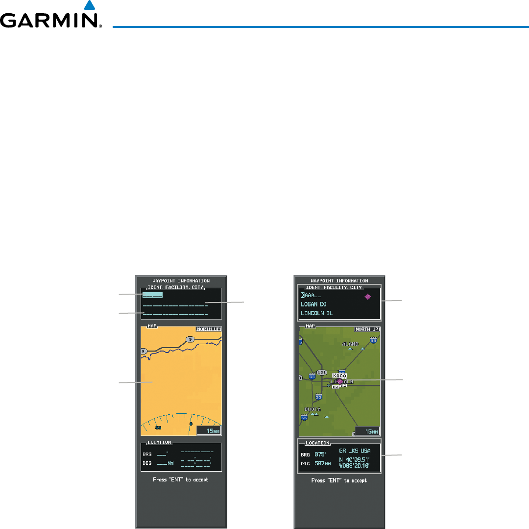
Figure 5-31 Waypoint Information Window
Map Area Showing
Entered Waypoint
Identifier Entry Field
Entered Waypoint on
Map
Facility
Entry Field
City Entry Field
- Waypoint Identifier
- Type (symbol)
- Facility Name
- City
Waypoint Location
If duplicate entries exist for the entered facility name or location, additional entries may be viewed by continuing
to turn the small FMS Knob during the selection process. If duplicate entries exist for an identifier, a Duplicate
Waypoints Window is displayed when the ENT Key is pressed.