


Garmin G1000H
™
Pilot’s Guide for the Bell 407GX
190-01255-00 Rev. B390
ADDITIONAL FEATURES
8.2 SAFETAXI
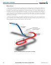
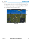
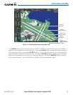
SafeTaxiisanoptionalfeaturethatgivesgreatermapdetailwhenviewingairportsatcloserange.Themaximum
maprangesforenhanceddetailarepilotcongurable.Whenviewingatrangescloseenoughtoshowtheairport
detail, the map reveals taxiways with identifying letters/numbers, airport Hot Spots, and airport landmarks
includingramps,buildings,controltowers,andotherprominentfeatures.Resolutionisgreateratlowermap
ranges.WhentheMFDdisplayiswithintheSafeTaxiranges,theairplanesymbolontheairportprovidesenhanced
positionawareness.
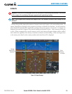
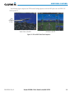
DesignatedHotSpotsarerecognizedatairportswithmanyintersectingtaxiwaysandrunways,and/orcomplex
ramp areas. Airport HotSpots are outlinedto cautionpilots ofareas onan airportsurface where positional
awarenessconfusionorrunwayincursionshappenmostoften.HotSpotsaredenedwithamagentacircleor
outlinearoundtheregionofpossibleconfusion.
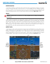
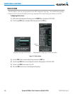
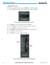
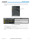
AnymappagethatdisplaysthenavigationviewcanalsoshowtheSafeTaxiairportlayoutwithinthemaximum
conguredrange.ThefollowingisalistofpageswheretheSafeTaxifeaturecanbeseen:
•NavigationMapPage
•InsetMap(PFD)
•WeatherDatalinkPage
•AirportInformationPage
•IntersectionInformationPage
•NDBInformationPage
•VORInformationPage
•UserWaypointInformationPage
•TripPlanningPage
•NearestPages
•ActiveandStoredFlightPlanPages
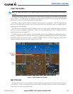
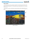
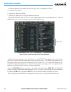
During groundoperations theaircraft’sposition isdisplayed inreferenceto taxiways,runways, andairport
features.In theexampleshown,the aircraftison taxiwayBravoinsidethe HighAlertIntersectionboundary
onKSFOairport.AirportHotSpotsareoutlinedinmagenta.Whenpanningovertheairport,featuressuchas
runwayholdinglinesandtaxiwaysareshownatthecursor.