


Garmin G1000H
™
Pilot’s Guide for the Bell 407GX
190-01255-00 Rev. B318
HAZARD AVOIDANCE
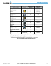
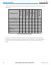
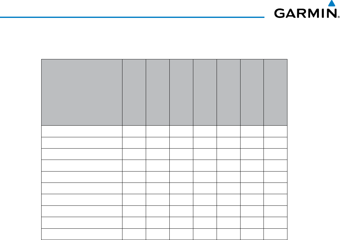
Table6-4showswhichGFDSWeatherproductscanbedisplayed(indicatedwitha‘+’symbol)onspecic
G1000H maps.
GFDS Weather Product
PFD Inset Map
Navigation Map Page
Weather Data Link
(GFDS) Page
Weather Information
Page
AUX - Trip Planning
Page
Nearest Page Group
Flight Plan Pages
Precipitation (PRECIP) + + + + + +
Infrared Satellite (IR SAT) +
Datalink Lightning (LTNG) + + + + + +
SIGMETs/AIRMETs (SIG/AIR) +
METARs + + + + + + +
Winds Aloft (WIND) +
PIREPs + +
Radar Coverage + + +
TFRs + + + + + + +
TAFs + +
Table 6-4 GFDS Weather Product Display Maps
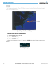
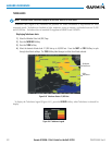
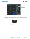
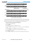
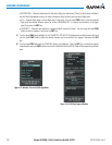
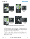
SoftkeyscontrolthedisplayofweatherinformationonmostMFDpagesandthePFDInsetMap(Figure
6-46showstheweatherproductsoftkeysfortheWeatherDataLink(GFDS)Page).Whenaweatherproduct
isselectedfordisplay,thecorrespondingsoftkeylabelchangestograytoindicatetheproductdisplayis
enabled.