


Embraer Prodigy
®
Flight Deck 100 Pilot’s Guide
190-00728-04 Rev. A190
FLIGHT MANAGEMENT
SYMBOL SETUP
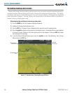
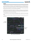
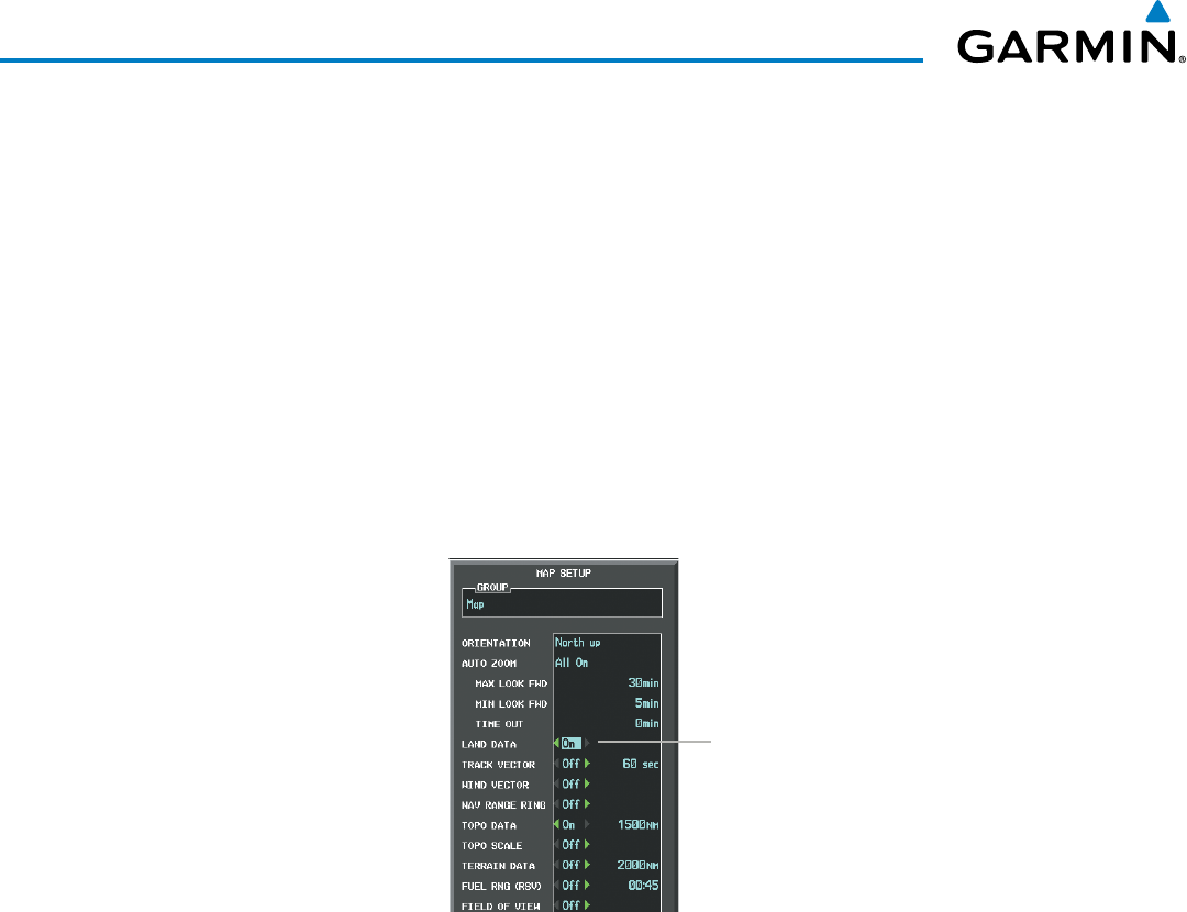
All pages with maps can display land symbols (roads, lakes, borders, etc). Land symbols can be removed
totally (turned off).
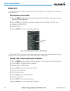
Displaying/removing all land symbols:
1) Press the MENU Key with the Navigation Map Page displayed. The Page Menu is displayed and the cursor
flashes on the ‘Map Setup’ option.
2) Press the ENT Key. The Map Setup Group Menu is displayed and the cursor flashes on the ‘Map’ option.
3) Highlight the ‘LAND DATA’ field.
4) Select ‘On’ or ‘Off’.
5) Press the FMS Knob to return to the Navigation Map Page.
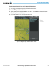
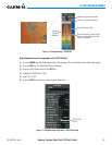
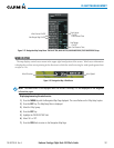
Figure 5-18 Navigation Map Setup Menu - LAND DATA Setup
LAND DATA
On/Off
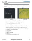
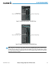
Thelabelsize(TEXT)setsthesizeatwhichlabelsappearonthedisplay(none,small,medium,andlarge).
The range (RNG) sets the maximum range at which items appear on the display.
Selecting a ‘Land’ or ‘Aviation’ group item text size and range:
1) Press the MENU Key with the Navigation Map Page displayed. The cursor flashes on the ‘Map Setup’ option.
2) Press the ENT Key. The Map Setup Menu is displayed.
3) Select the ‘Land’ or ‘Aviation’ group.
4) Press the ENT Key. The cursor flashes on the first field.
5) Select the desired land option.
6) Select the desired text size.
7) Press the ENT Key to accept the selected size.
8) Select the desired range.
9) Press the ENT Key to accept the selected range.
10) Press the FMS Knob to return to the Navigation Map Page.