


Embraer Prodigy
®
Flight Deck 100 Pilot’s Guide
190-00728-04 Rev. A
358
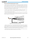
HAZARD AVOIDANCE
NEXRAD AND AIRBORNE WEATHER RADAR
BothAirborneWeatherRadarandNEXRADmeasureweatherreectivityindecibels(dB).Adecibelisa
logarithmicexpressionoftheratiooftwoquantities.AirborneWeatherRadarmeasurestheratioofpower
againstthegainoftheantenna,whileNEXRADmeasurestheenergyreectedbacktotheradar,ortheradar
reflectivity ratio.
Bothsystemsusecolorstoidentifythedifferentechointensities,butthecolorsarenotinterchangeable.
Airbornecolorradar valuesusedbyGarminAirborneColorWeather Radarshouldnotbeconfusedwith
NEXRADradarvalues.
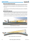
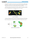
ANTENNA BEAM ILLUMINATION
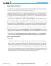
Theradarbeamismuchlikethebeamofaspotlight.Thefurtherthebeamtravels,thewideritbecomes.
Theradarisonlycapableofseeing whatisinside theboundariesofthebeam.Thegurebelowdepicts
a radarbeam’s characteristics. Thegure illustratesvertical dimensionsof theradar beam,although the
sameholdstrueforthehorizontaldimensions.Inotherwords,thebeamisaswideasitistall.Notethat
itispossibletomissareasofprecipitationontheradardisplaybecauseoftheantennatiltsetting.Withthe
antennatiltsettozerointhisillustration,thebeamovershootstheprecipitationat15nauticalmiles.
Figure 6-50 Radar Beam from a 12 inch Antenna
0
80
Altitude (x1000 ft.)
30 0 45 60 75 90
Range (nautical miles)
Half Power at Beam Sidelobes
Antenna at Zero Tilt
18,000 ft.
18,000 ft.
Max Power at Beam Center
15
8°
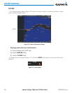
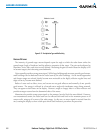
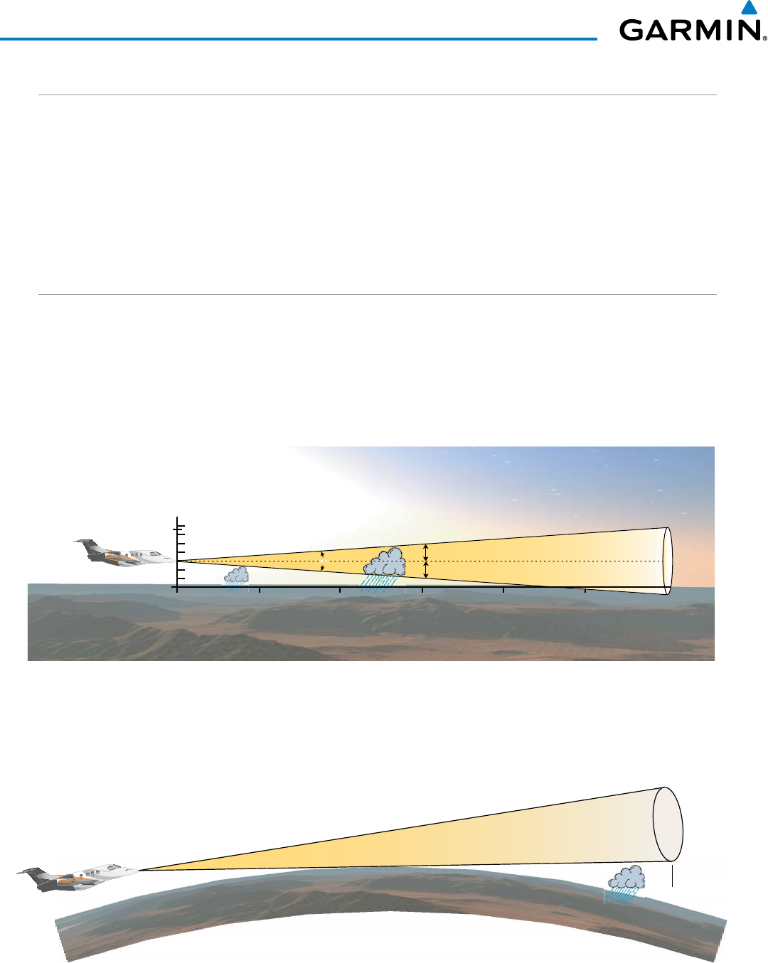
Thecurvatureoftheearthcanalsobeafactorinmissingareasofprecipitation,especiallyatrangesettings
of150nauticalmilesormore.Herethebeamovershootstheprecipitationatlessthan320nauticalmiles.
320 nm
Figure 6-51 Radar Beam in Relation to the Curvature of the Earth