


Embraer Prodigy
®
Flight Deck 100 Pilot’s Guide
190-00728-04 Rev. A204
FLIGHT MANAGEMENT
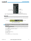
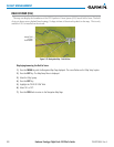
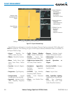
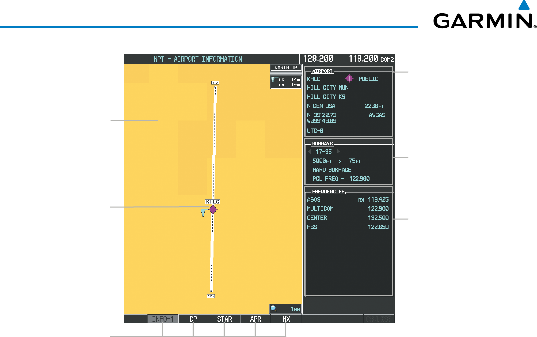
Figure 5-33 Airport Information Page
Airport/Runway
Diagram
Navigation Map
Showing Selected
Airport
Runway Information
- Designation
- Length/Width/Surface
- Lighting Available
Airport Information
- ID/Facility/City
- Usage Type/Region
- Lat/Long/Elev
- Fuel Available
- Time Zone (UTC Offset)
COM/NAV Freq. Info.
- Identification
- Frequency
- Availability
- Additional Information
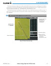
Softkeys
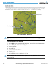
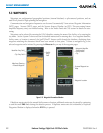
The AOPA directory information is viewed on the Airport Directory Page by pressing the INFO softkey until
INFO-2 is displayed. The following are types of AOPA airport directory information shown (if available) on
the Airport Directory Page:
•Airport: Identifier, Site
Number, Name, City, State
•Traffic Pattern Altitudes
(TPA): Aircraft Class/Altitude
•Runway: Headings, Length,
Width, Obstructions, Surface
•Phones: Phone/Fax Numbers •Weather: Service Type,
Frequency,PhoneNumber
•Obstructions: General Airport
Obstructions
•Hours: Facility Hours, Light
Hours, Tower Hours, Beacon
Hours
•Flight Service Station (FSS):
FSS Name, Phone Numbers
•Special Operations at
Airport
•Location: Sectional, Magnetic
Variation
•Instrument Approaches:
Published Approach,
Frequency
•Services Available: Category,
Specific Service
•Frequencies:Type/Frequency •NAVAIDS: Type, Identifier,
Frequency,Radial,Distance
•Notes: Airport Notes
•Transportation: Ground
Transportation Type Available
•Noise: Noise Abatement
Procedures
•Pilot Controlled Lighting:
High/Med/Low Clicks/Second
•Approach: Approach Facility
Name, Frequency, Frequency
Parameter
•Charts: Low Altitude Chart
Number
•FBO: Type, Frequencies,
Services, Fees, Fuel, Credit
Cards, Phone/Fax Numbers