


190-00728-04 Rev. A
Embraer Prodigy
®
Flight Deck 100 Pilot’s Guide
361
HAZARD AVOIDANCE
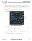
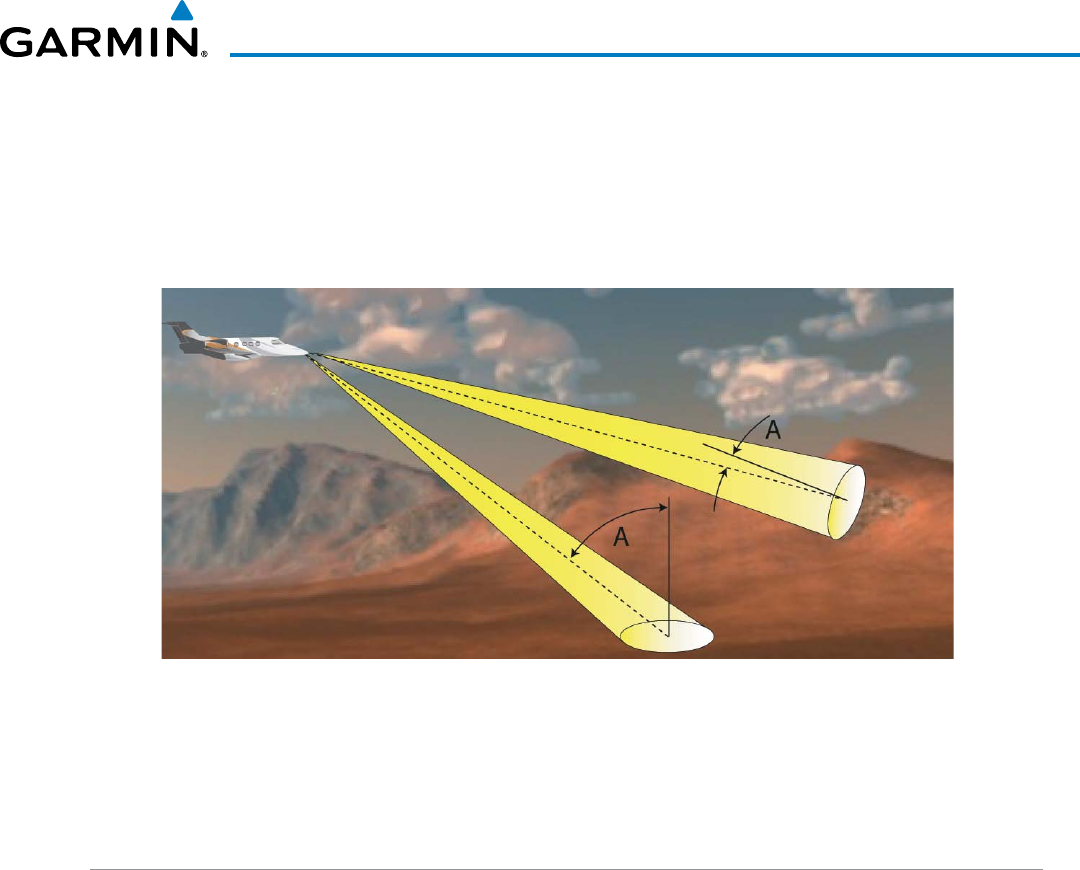
angle of inciDence
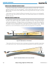
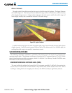
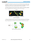
TheangleatwhichtheradarbeamstrikesthetargetiscalledtheAngleofIncidence.Thegureillustrates
theincidentangle(‘A’).Thisdirectlyaffectsthedetectablerange,theareaofillumination,andtheintensity
ofthedisplayedtargetreturns.Alargeincidentanglegivestheradarsystemasmallerdetectablerangeand
lower display intensity due to minimized reflection of the radar energy.
Figure 6-53 Angle of Incidence
Asmallerincidentanglegivestheradaralargerdetectablerangeofoperationandthetargetdisplayshows
ahigherintensity.Sincemoreradarenergyisreectedbacktotheantennawithalowincidentangle,the
resulting detectable range is increased for mountainous terrain.
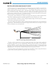
SAFE OPERATING DISTANCE
The following information establishes a minimum safe distance from the antenna for personnel near
operatingweatherradar.TheminimumsafedistanceisbasedontheFCC’sexposurelimitat9.3to9.5GHzfor
generalpopulation/uncontrolledenvironments,whichis1mW/cm2.SeeAdvisoryCircular20-68Bformore
information on safe distance determination.
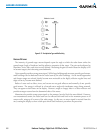
MAXIMUM PERMISSIBLE EXPOSURE LEVEL (MPEL)
ThezoneinwhichtheradiationlevelexceedstheUSGovernmentstandardof1mW/cm2isthesemicircular
areaofatleast11feetfromthe12-inchantenna.Allpersonnelmustremainoutsideofthiszone.Witha
scanningorrotatingbeam,theaveragedpowerdensityattheMPELboundaryissignicantlyreduced.