


190-00728-04 Rev. A
Embraer Prodigy
®
Flight Deck 100 Pilot’s Guide
439
HAZARD AVOIDANCE
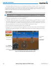
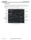
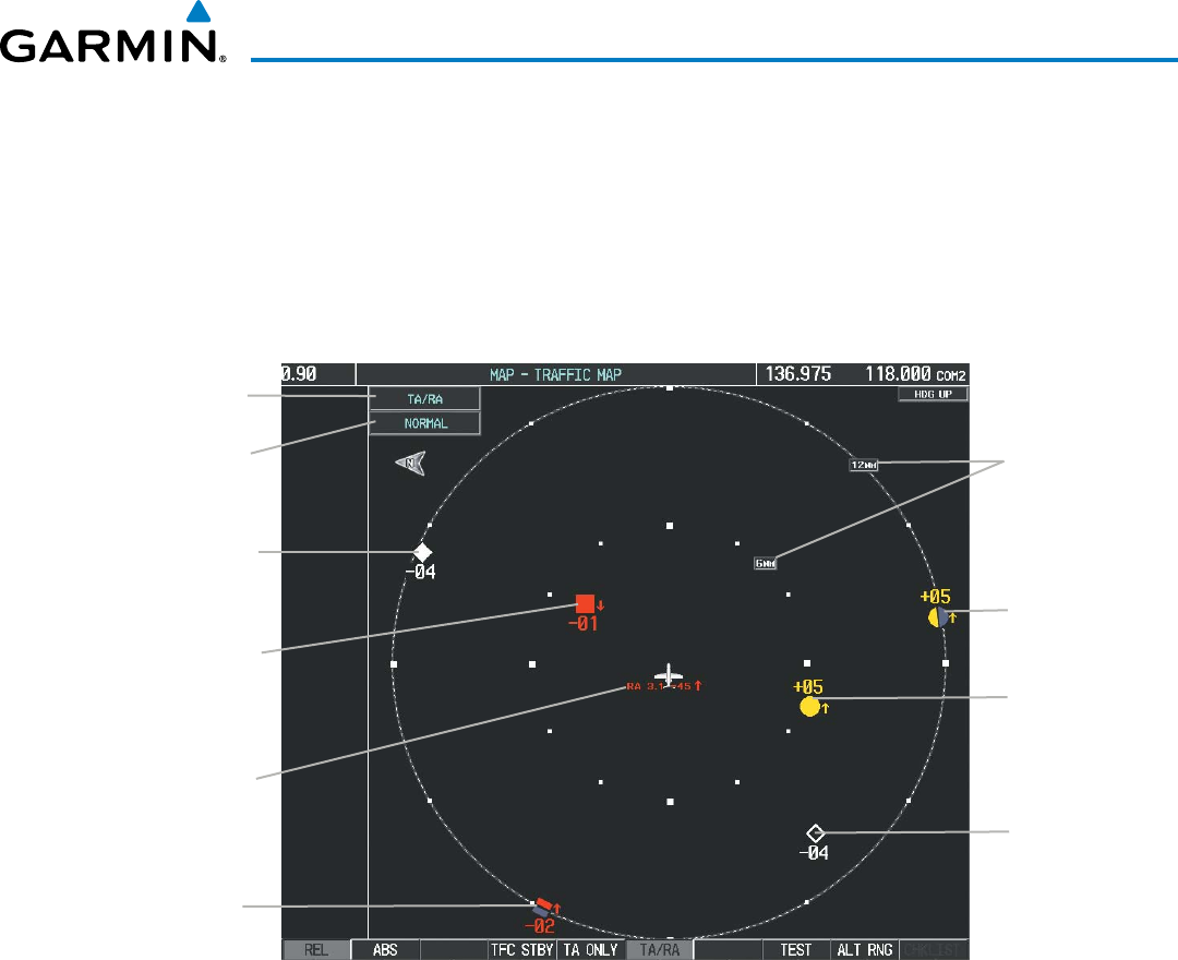
TRAFFIC MAP PAGE
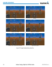
TheMap -Trafc MapPage showssurroundingTCAS IItrafcdata inrelationto theaircraft’scurrent
positionandaltitude,withoutbasemapclutter.ItistheprincipalMFDmappageforviewingTCASIItrafc.
Aircraftorientationisalwaysheadingupunlessthereisnovalidheading.Maprangeisadjustablewiththe
RANGE Knobfrom2to40nm,asindicatedbythemaprangerings.
Thetrafcmodeandaltitudedisplaymodeareannunciatedintheupperleftcorner.
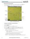
Figure 6-126 Traffic Map Page
Operating
Mode
Altitude
Mode
Off Scale Traffic
Advisory
Off Scale
Resolution
Advisory
Resolution
Advisory,
100’ Below,
Descending
Proximity
Traffic, 400’
Below, Level
Traffic Display
Range Rings
“Non-Bearing”
(Bearing Unknown)
Resolution Advisory,
Distance 3.1 nm,
4500’ Below,
Climbing
Traffic Advisory,
500’ Above,
Climbing
Non-Threat
Traffic, 400’
Below, Level