


190-00728-04 Rev. A
Embraer Prodigy
®
Flight Deck 100 Pilot’s Guide
293
FLIGHT MANAGEMENT
5.11 NAVIGATING A FLIGHT PLAN
The following discussion is an example of navigating a flight plan with the SBAS capable GPS system while the
system provides vertical guidance through descents. A lateral flight plan (LNAV) would be navigated in much the
same way, but would not include vertical guidance when the final approach course is active.
NOTE: The following example flight plan is for instructional purposes only. All database information depicted
should be considered not current.
The example is a flight plan from KMKC to KCOS filed using the TIFTO2 departure, various Victor Airways,
andtheDBRY1arrivalwiththetransitionatTBE.Theightplanincludesanenroutealtitudeof12,000feet,an
LPV (WAAS) approach selected for runway 35R, and a missed approach executed at the Missed Approach Point
(MAP). A few enroute changes are demonstrated.
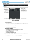
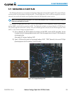
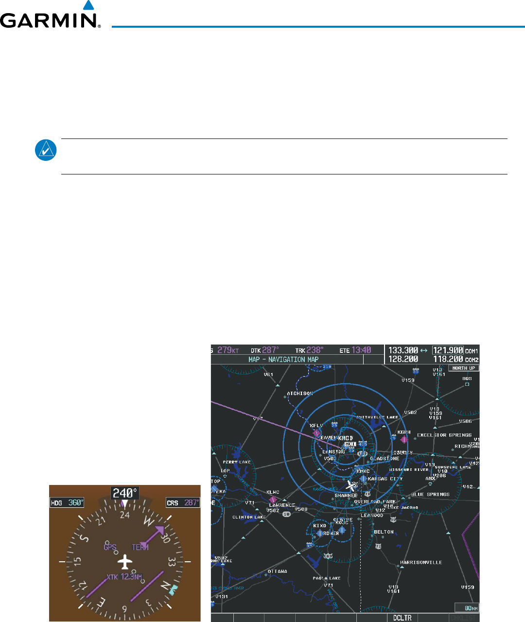
1) Prior to departure, the TIFTO2 departure, the airways, and the DBRY1 arrival at KCOS are loaded. See the
Procedures section for loading departures and arrivals. Note the magenta arrow in Figure 5-106 indicating the
active departure leg.
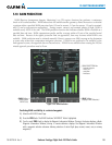
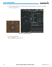
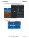
After takeoff, ATC assigns a heading of 240º.
2) Figure 5-106 shows the aircraft on the assigned heading of 240º. ‘TERM’ (Terminal) is the current CDI flight
phase displayed on the HSI indicating 1.0 nm CDI scaling.
Figure 5-106 Assigned Heading of 240º