


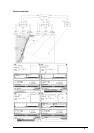
146 · Raster Chart material
or shift is known only some parts of chart (=Partially
defined).
Depth:
Indication of used measurement units of depth.
Height:
Indication of used measurement units above sea level (for example clearance height).
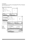
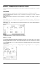
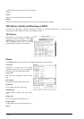
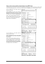
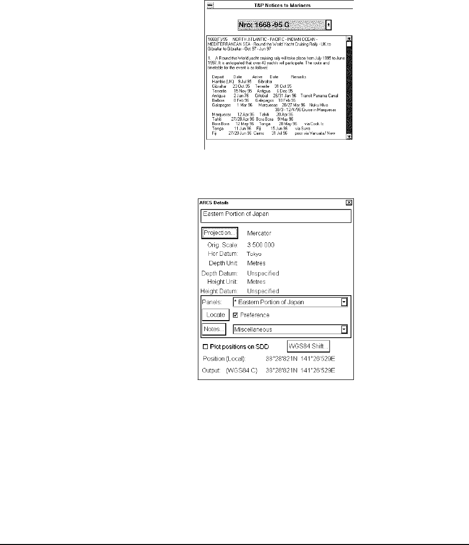
T&P Notices, Details and Warnings of ARCS
Access to view T&P Notices, Details or Warnings of ARCS is in a Legend of ARCS chart. In lower part of the
Legend there are three buttons to activate corresponding window.
T&P Notices…
T&P Notices are also known as Temporary and
Preliminary Notices to Mariners. Press T&P
Notices button to open text window, providing
chart information that does not warrant
permanent chart correction, can be viewed.
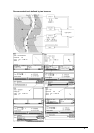
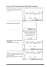
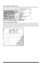
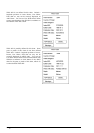
Details…
Press Details button to open window where detailed information of chart is shown.
Projection:
Projection of current chart. By pressing
projection button user gets more information
of latitude of true scale and rotation angle.
Orig. Scale:
The scale of the origin paper chart is shown
here.
Hor Datum:
Horizontal datum used with current chart.
Depth Unit:
Unit of depth used with current chart.
Depth Datum:
Vertical datum of depth used with current
chart.
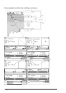
Height Unit:
Unit used for objects locating above sea
Height Datum:
Vertical datum for objects locating above sea.
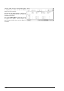
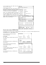
Panels: