


168 · Raster Chart material
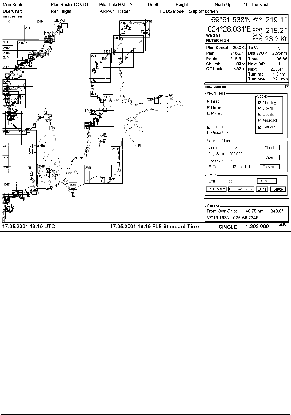
ARCS Catalogue
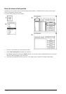
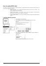
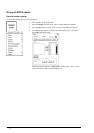
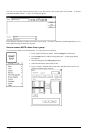
For the managing of ARCS charts it is possible to use ARCS Catalogue command. This command is available from
CHART PLAN menu. By choosing this command an ARCS Catalogue window opens up in the Electronic chart
area and ARCS Catalogue dialog appears in the dialog box area.
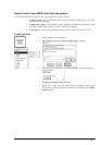
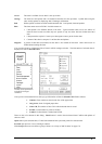
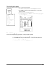
View filters:
User can filter ARCS chart limits displayed in ARCS Catalog window selecting desired options in View filters -field.
There are different categories for the ARCS charts depending on scale of them. The categories are:
1. Planning
2. Ocean
3. Coastal
4. Approach
5. Harbour
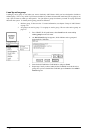
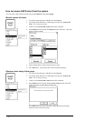
Selection of Inset displays insets included in charts, selection of Name displays ID number of charts and selection of
Permit displays limits only for charts which the system has permit to use.
Selection of All Charts displays limits for all the ARCS charts available and selection of Group Charts displays
limits for user defined group charts.
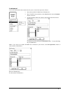
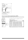
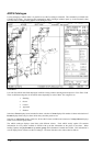
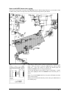
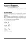
The ARCS catalogue displays chart limits with different colours. Each ARCS weekly update CD contains
information for every charts available in UKHO with up-to-date information at the point of issue date. When
loading Updates using by Permits or by Active group, this information is loaded into ECDIS. This information is
used to display limits of charts on ARCS Catalogue. The chart limit boxes are colour coded as follows: