


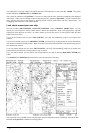
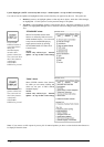
186 · Raster Chart material
Ship true symbol scale limit, own ship is displayed as true scale symbol, if the displayed chart scale is larger than
selected limit scale here and if the size of the true scale symbol is longer than 6 mm on the chart display.
.
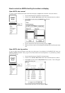
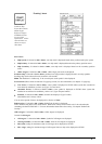
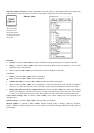
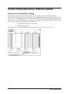
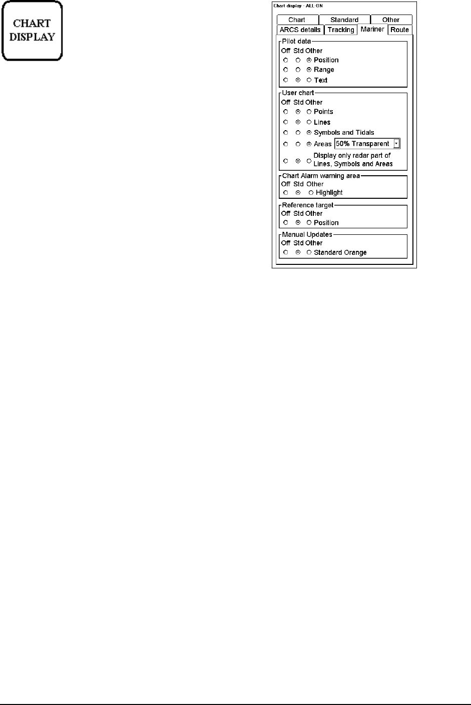
Pilot data, User
chart and Chart
alarms are non-
chart information.
All the selected items
are shown on top of
chart data
“Mariner” sheet
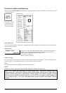
Pilot data:
· Position, if selected as Std or Other, positions of Pilot Data records are displayed as a symbol on the chart.
· Range, if selected as Std or Other, range circles around Pilot Data records are displayed. Size of circle
depends on value set in Pilot Data.
· Text, if selected as Std or Other, text of Pilot Data records are displayed on the chart.
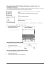
User chart
· Points, if selected as Std or Other, Points are displayed.
· Lines, if selected as Std or Other, Lines are displayed
· Symbols and Tidals, if selected as Std or Other, Symbols and Tidals are displayed.
· Area, if selected as Std or Other, Areas are displayed. Colour fill of the areas can be selected as transparent
from 25 to 75% and as No colour fill. If No colour fill is selected, only the boundaries of the areas are visible.
· Display only radar part of Lines, Symbols and Areas, if selected as Std or Other, only those Lines, Symbols
and Areas are displayed, which has user selection "on radar" activated for them in the User Chart. This selector
is used to view only that part of the User Chart, which will be sent to the ARPA radar connected to the system.
Chart Alarm warnings Area, if selected as Std or Other, Chart Alarm warnings areas are displayed in red
highlight colour.
Reference target, if selected as Std or Other, reference targets are displayed.
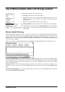
Manual Updates, if selected as Std or Other, Manual Updates made as Orange symbol are displayed.
NOTE, Visibility of Manual Updates made as True symbols are controlled through Standard and Other pages of
Chart Display.