


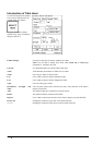
270 · User chart control
How to create User Chart
You can create and modify an User Chart when you have select Plan mode of User Chart.
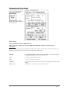
1.
2.
3.
4.
5.
6.
7.
Note:
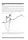
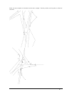
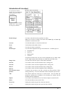
If you want User chart to be displayed on the electronic chart make sure, that Points, Symbols & Tidals, Lines and
Areas of User chart are selected in Mariner sheet.
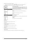
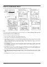
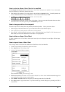
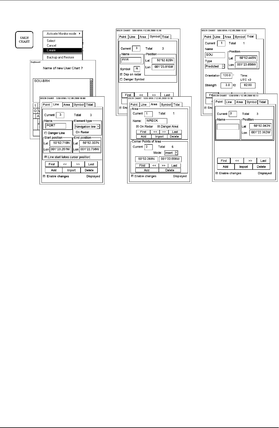
To make a complete User Chart, proceed as follows:
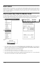
1. Press twice USER CHART button. Select Create from the menu.
2. Enter a name for User Chart using Keypad dialog box and press OK.
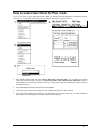
3. Open Line page of User Chart. Use Cursor and SELECT button to define location of start point of line. Define
Name and Element type for line. Use cursor and SELECT button to design shape of lines. To start new line
from new position select Line start takes cursor position. Option "Danger Line" enables it to be used in
ChartAlarm calculation.
4. Open Symbol page of User Chart. Use Cursor and SELECT button to define location of Symbol. Define Name
and used Symbol. Option "Dsp on radar" is automatically selected. Option "Danger Symbol" enables it to be
used in ChartAlarm calculation.
5. Open Area page of User Chart. To make a new area, press Add button in Area -field. Define Name for area,
define also if it is displayed on Radar display (On Radar) and used in Chart Alarms calculation (Danger Area).
Use Cursor and SELECT button to define location Corner Points of Area.
6. Open Tidal page of User Chart. Use Cursor and SELECT button to define location of Tidal symbol. Define
Name, Type, Orientation, Strength and Time for Tidal. The Tidal symbol is displayed only on ECDIS
display.
7. Open Point page of User Chart. Use Cursor and SELECT button to define location of Points.