


User chart control · 273
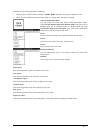
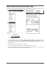
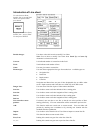
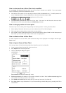
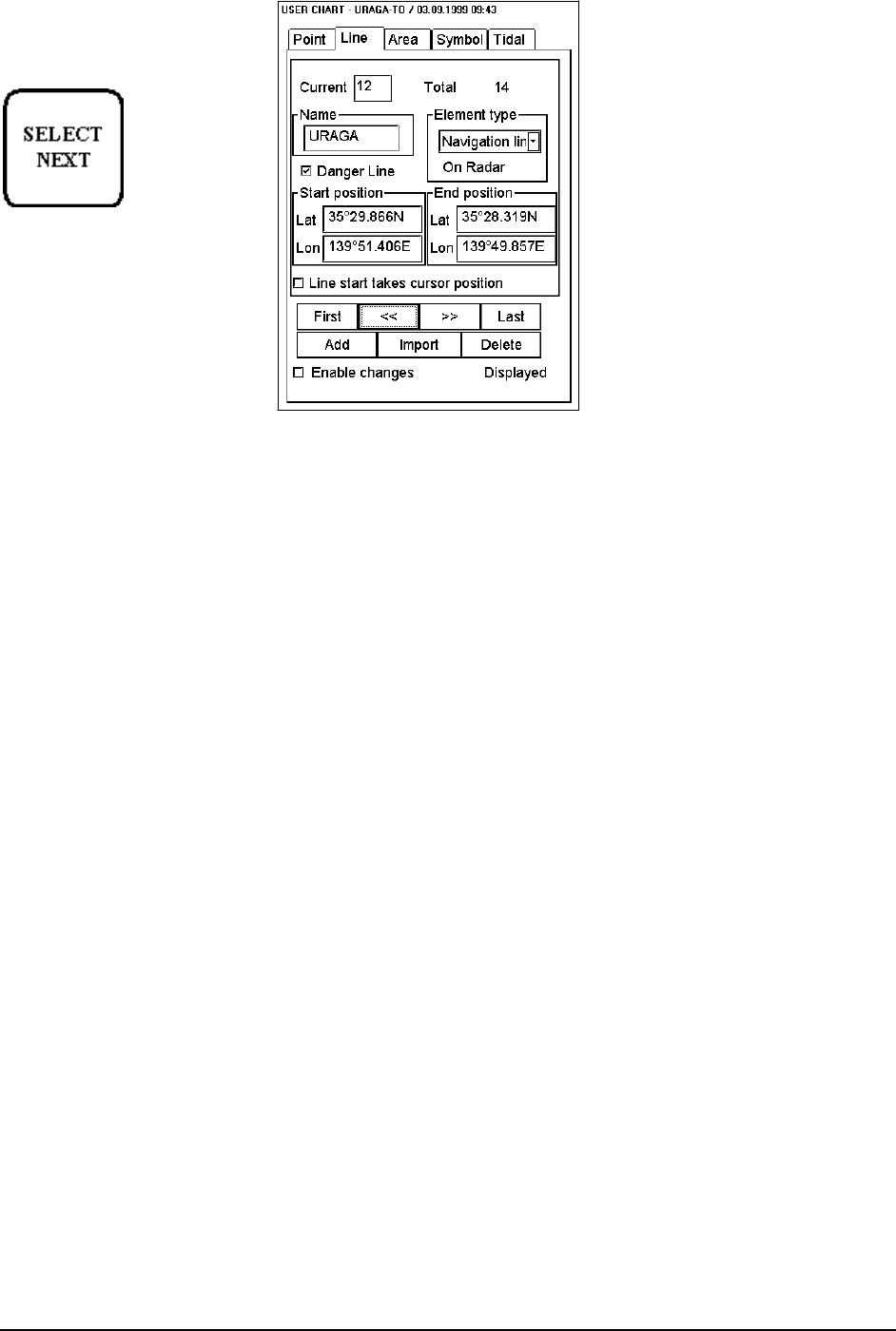
Introduction of Line sheet
To select between Point,
Symbol, Line, Area and Tidal
sheets to be opened either
press button
or go by cursor above Point,
Symbol, Line , Area or Tidal
text and press SELECT
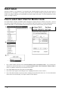
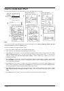
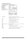
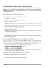
Enable changes:
User has to select this in order to modify User Chart.
Note! You are able to modify User Chart when North Up or Course Up
orientation is selected to be used.
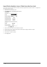
Current:
It is indicated number of current line in this field.
Total:
Total indicates total number of lines.
Name:
User can give name to current line.
Element type:
User can choose appropriate line type from combo box. Available types are:
· Navigation line
· Route line
· Depth contour
· Coast line
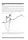
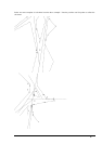
Navigation and Route lines are part of lines displayable also on ARPA radar
screen. Depth contours and Coast lines are visible only on ECDIS screen.
Danger Line:
User can select if the line is part of Chart Alarm calculation.
Start lat:
User is able to enter to edit box latitude of line’s starting point.
Start lon:
User is able to enter to edit box longitude of line’s starting point.
End lat:
User is able to enter to edit box latitude of line’s ending point.
End lon:
User is able to enter to edit box longitude of line’s ending point.
Line start takes cursor
position:
If selected, user can draw a new line so that he can select position of line's
starting point freely. If it is not selected line will be connected to previous line.
Add:
This function adds new record next to current record. User can either edit
position by entering new co-ordinates or by showing new location with the
trackball and select pushbutton.
Import:
User is able to select from the list of User Chart to import to current line file.
Delete:
This function deletes current record of line.
First, Last:
Pushing this control user gets first or last line of the file.
>>, <<:
Pushing this control user gets next or previous line of the file.